
3D Visualization Software
for Marine Resources and Geoscience
 Visual3DX-7
| About Visual 3DX |
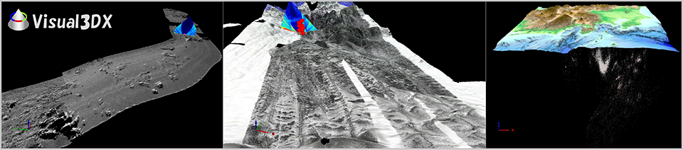
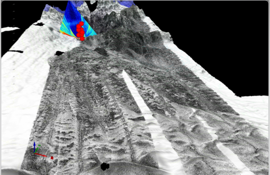
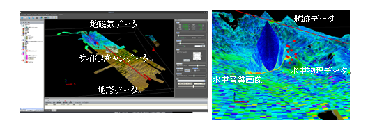
Visual3DX is ideal software to bundle for Geospatial data that visualizes Bathymetric data obtained by multibeam echo sounders, Sidescan sonar images, Gravity data, Magnetic data, Physical data, and SBP images obtained by subbottom profilers in the three-dimensional space.
Visual3DX-7 newly supports input of speed structure data and core data.
- Displays complex geospatial datasets in the three-dimensional space
- Display of a cross-sectional view
- Changes image scale (extension reduction and rotation), and also moving viewpoint as if maneuvering a flight simulator
- Exports high-resolution bitmap images
- Creates animations by easy and visible operation
Loading Video... If you're seeing this message you may not have Flash installed.
| Main Use of Visual 3DX |
3D still images and animations created by Visual3DX recommend for bundle of Geospatial data.
- Presentation at conferences
- Journal manuscript
- Exhibitions, Web pages
| Main features of Visual 3DX | ||||||||||||||||
| ■ 3D view of observation and analysis data | ||||||||||||||||
|
||||||||||||||||
 |
||||||||||||||||
| □ Image optimization | ||||||||||||||||
In each mode, optimized display can be achieved by calculating available amount of graphic board memory. |
||||||||||||||||
| □ Changing image scale, and moving viewpoint as if like a flight simulator | ||||||||||||||||
|
||||||||||||||||
| ■ Display of a cross-sectional view | ||||||||||||||||
|
||||||||||||||||
| ■ Exporting high-resolution images (camera output function) | ||||||||||||||||
|
||||||||||||||||
| ■ Creating animation | ||||||||||||||||
|
||||||||||||||||
| ■ Other various functions | ||||||||||||||||
| □ Manage input file for each layer | ||||||||||||||||
|
||||||||||||||||
| □ By the coloring table editing function, edit the color of the input data on the screen and save | ||||||||||||||||
|
||||||||||||||||
| □ Display of mark and placard | ||||||||||||||||
|
||||||||||||||||
| □ The 3D information window, to manage the following information | ||||||||||||||||
|
||||||||||||||||
| ■ Importable data | ||||||||||||||||
|
||||||||||||||||
| ■ Exportable data | ||||||||||||||||
|
||||||||||||||||
| ■ Operating environment | ||||||||||||||||
| OS | Windows 10, 11 (64 bit) | |||||||||||||||
| CPU | Intel Core i7 2600K or above | |||||||||||||||
| Memory | 8 GB or more | |||||||||||||||
| Hard disk | 50 GB or more | |||||||||||||||
| Graphic board | Supports DirectX 9.0c and above | |||||||||||||||
| Monitor | Resolution: 1280 x 1024 or higher Number of colors: True Color 32 bit or higher |
|||||||||||||||